Very soon – if it hasn’t already started happening by the time you read this – you will see thin trenches (less than 500mm wide) being dug at regular intervals in the Lincoln Road berms and at less regular intervals, across the road itself. Mostly they’ll be dug at night – especially those in the road – and be filled in again by morning.
Why?
To be sure we have the best possible idea of where the under-surface services are located.
In between the trenches and in difficult locations, contractors will be reading the sub-surface with ground-penetrating radar.
Again, why?
As the Irishman said, “to be sure, to be sure”.
This is all part of the process of knowing where things are before we start works. It will help to avoid finding unhappy surprises once we do start.
This sub-surface exploration is only one of the testing regimes that AT will carry out before any works start. We’ve already tested for contamination. Next will be testing the soil on which the road will be built and finding its mechanical characteristics and the water-table level. And we’ll also be testing the strength of the current “pavement” which includes the layers of compacted materials on which the surface asphalt is laid. This is to see if it meets today’s demands and standards for future decades of service.
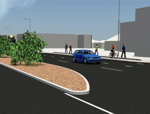
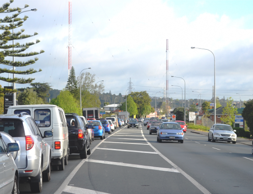
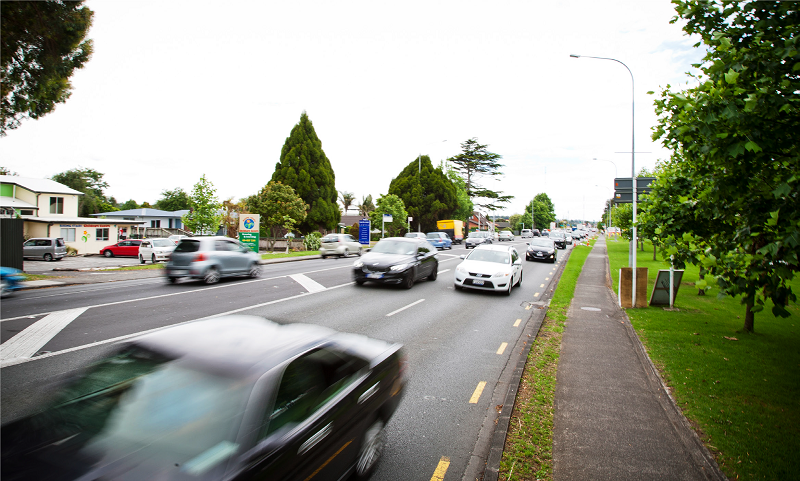
Above the surface we’ve done extensive traffic monitoring of a very large area from Te Atatu to Swanson, to discover the actual traffic patterns that create the traffic on Lincoln Road.
And that’s just the start of the research we’re doing.
Part of this is necessary because there are many things we don’t know for sure; and part is because the rules and requirements for building roads have changed in recent years and we have to be sure that what is planned measures up to what is required.
The problem with underground services – phone, fibre, electricity, gas (if it’s there), water, sewerage and stormwater – is that maps are usually approximate when first drawn and then the locations of the services can change over many years as they are added to, decommissioned, or repaired and when new services are added, all slotted in where the installers can find a place.
People who’ve been around a while, will readily understand now much new development has happened in the last two decades and with it, a massive increase in the new services that have had to be provided.
And it’s not just services for properties on Lincoln Road. Trunk services that supply the side streets – some of which – like the Universal Drive and Paramount Drive extensions didn’t even exist a decade ago – are often delivered via connections running back to Lincoln. On top of that we have to be sure that the services are future proofed to allow them to expand to meet the demand that will come as population and the business sector grow. On top of that again, connections have to cross under the surface of Lincoln Road from one side to the other.
The trenches will confirm that the services are where we think they are and if not, they will help us locate their exact path. This is expensive and disruptive work and so we won’t dig continuous trenches but will map between the trenches using ground-penetrating radar.
You might ask, why not use radar for the whole job? Unfortunately, it isn’t 100 percent reliable; it picks up some things but not others, picks up some things in some places but not in others. However the combination of trenching and radar can combine to give us certainty in many places and a high degree of probability in the rest.
Because we can only do a small amount each night (in order to have the ground reinstated for morning traffic and business operations) this will take about 20-26 weeks. However, when that is complete we will have a base survey which can be used in creating 3D computer models of what lies beneath the ground. This will show us exactly where we need to dig what is known as a common services trench for the replacement services. It will also give us images of both horizontal layouts – sewage and storm water pipes for example, must be laid side by side whereas phone and power cables can be stacked vertically one above the other.
This is all critical for four reasons. First, we have a good chance of “doing it once and doing it right”; second, once we have a full picture of the current services we can model where to put the new services (which until the work is completed will be a duplicate). It will also show us whether the new services can be side-by-side or stacked, of a mix of both; third, we can install all the new services and then cut-over from the old set to the new, without disrupting supply to customers.
The fourth reason is that it takes specialists to install some of the services and/or connections, and to do the cut-over from old to new. However, with Auckland’s full-on growth, these specialists and their equipment are in short supply and much in-demand. So, we need to be as accurate as possible in planning how much of everything we need and order it in good time and, then synchronise the availability of materials to the availability of specialists.
One benefit arising from all of this comes when we have installed the new service conduits, in the single common services trench. Here the conduits for all the services will be placed in a sequence and at the correct distance from each other. These conduits are pipes with power, phone and fibre cables inside them with sufficient cables/cable capacity to meet projected phone, power and data demand for the foreseeable future. They are also large enough for the utility companies to draw new cables through when demand increases.
It is important to note that other project elements will continue to progress during this period. These include final geometric design road, traffic modelling, consents/planning and property/land negotiations and purchase.
The other part of the project that may soon be manifesting signs of happening, are the works to upgrade from Central Park Drive/Triangle Rd, into the interchange with the North Western Motorway,.
This is being undertaken by NZTA on our behalf ahead of the main project because NZTA needs to synchronise these works the motorway improvements between Lincoln and Westgate.
It is possible that we’ll have some news for you by the time of our next article, in September.
Testing for contamination was a chemical process. While there was very little contamination that we didn’t expect, there will be specialists on hand during construction in case something does come to light. We’ll also have a detailed plan for how to remove and dispose of contaminated materials if any are found.
Testing the nature of the soil and water table below the road is more mechanical and will tell us whether additional drainage is needed either now or to future proof the ground for future climate change. As retaining walls will need to be built in many places at the boundary between road and properties (either to support the edge of the road or to support the properties), knowing the nature of the soil will tell us how large and strong the walls and their foundations need to be. It will also tell us whether the soil can take the pressure of the bigger vehicles using our roads these days or additional strengthening will be necessary.
Likewise, testing the existing road pavement – the roading materials on top of the soil – will tell us the same things; is it strong enough for heavier weights or will we have to strengthen that as well?
This is all data that will be used to guide the design of the road that we will start building in due course. It helps to explain why the lead-up to this project is taking the time that it is. As they say in the military, ”time spent in reconnaissance is never wasted”.
Finally, there is all the data we have obtained from the traffic surveys already done, and those still to come.
What they can tell us is both fascinating and reassuring – but we’ll go into that in the next article.