The Devil is in the detail. And when it comes to upgrading a major arterial like Lincoln Road, there is detail for every metre of a project extending over 1.6 kilometres, that must be predicted, investigated, planned for and where necessary, problem solved.
To get to the start of actual works – “the start line” as far as the public is concerned – we must cover a great deal of ground: Detailed Design; the Outline Plan of Works; property acquisitions and their accompanying agreements of how effects on property will be mitigated; any consultation that may be necessary and adopting the changes they may suggest; a multitude of consents; a tender describing exactly and in detail what the contractor must achieve and finally; the amendments that arise from suggestions the contractor may have, for doing what we have designed a different way.
Finally, by sometime in 2021, we will be ready to actually start the works themselves.
In the middle of all of that, we have to run our communications plan with you, so that you know every step of the way, what we’re doing and why, and we know what your concerns are and are working to overcome them with you.
At the moment, the property acquisitions are underway and we’re at the start of the Detailed Design which is a description of everything that needs to be done to achieve every aspect of the upgrade, in minute detail. It is the “Manual of what has to be done”. This is being created by GHD, a leading international engineering and design company and won’t be completed before the end of 2018.
When that is settled, “what has to be done” must be translated into the Outline Plan of Works – perhaps best described as the “Manual of how to do it”. Once again, detail by detail.
And not just how things will be done but in what sequence. The start point for the detailed Design which will inform the Outline Plan of Works, has begun with bringing together all of the utility companies to describe to us what they need to do, or have provided to them, in order to move water supply, gas, electricity, phone and data (fibre) safely from their current position to their new position, once the the road is widened.
The next major workshop was to get everyone around the table a second time to explore the risks that each see; risks to themselves, risks to each other, risks to the properties along the road. By this we don’t mean risks to life or property, but risks to being able to get their vital tasks done in the right way and in the correct sequence – all without cutting off supply to the properties they serve.
Sequencing is vital. Some things must be done before others. This is true for the property acquisition, the Detailed Design and and Outline Plan of Works, and for all the detail that each is made up of.
We can’t, for example, widen the road itself until we have bought the property we need and concluded a “property agreement” that is individual to each property.
Each of these will include a plan of works of its own. Moving property boundaries involves building a new front boundary(fence/wall/ hedge/ garden), most of which are going to be different from their neighbours. Because, in places, land falls away from the road, or rises from it, we may have to install retaining walls; because many organisations share some of the properties, they have a share of parking and moving the boundaries closer to the buildings will compromise the parking available. We must find ways to solve such problems.
This process will be going on in the background over three years, moving from north to south so that we can fulfill our objective, of dividing the road works themselves into three main stages, starting at the Lincoln/Triangle/ Central Park intersection.
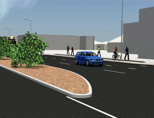
Taking too much property is one of the considerations we must take into account when positioning bus stops. People have asked why buses will stop in the T3 lane instead of us creating bus bays. The answer is that we need generally more than four metres of berm between the new kerb-line when the road is widened and the new front boundaries when they have been moved closer to the properties. If we use even more of the available land for bays at bus stops, we will have to buy even more land off the adjacent properties. This will be unfair (because it’s unnecessary and therefore, we probably wouldn’t get consent anyway), it will cause even more problems with sharing out the remaining land within the property and it will cost the ratepayer more.
The solution is free. Let the bus stop in the traffic lane; it won’t stop for long.
When have we moved the property boundaries we can then move the underground services closesr to the new boundaries. This is so that when the road surface is widened all the services will remain under a grass berm and not under the wider road surface.
Even this has its own plan of works. We will create what is called common services trench. All underground services will go in this trench (and not be installed higgedly-piggeldy as in the past). However, there is only just enough room for all the services to be installed in correct distance from each other. We will install the ducts for each and map them – and so there must be a plan for how they are each located.
To make sure this process doesn’t face the kind of hold ups that were encountered on other projects, a lot of effort is also being invested now, combining tried and true with the latest technology to locate where the services are now, so they can be efficiently moved later.
Even though broadly accurate versions of the Detailed Design and the Outline Plan of Works will be used early next year for consultation (where necessary), and to support consent applications, they will remain a work in progress throughout 2020 as fine detail is resolved and problems are solved. During this process, new information and new ideas will inevitably come to hand. This is an evolutionary process; new information can suggest new ways of doing things. Sometimes these are better ways; sometimes it can tell us that earlier ideas are not possible.The changes evolution brings about will call for revised plans, often through 360 degrees, each with its knock on effects.
Stay will us for the next gripping episode of “The Anatomy of a Road Re-build.”