All you wanted to know about Lincoln Road
…and were too scared to ask. by Auckland Transport

Artist’s impressions of the median barrier in Lincoln Road
At the end of the August article we said that the traffic survey data we have been collecting, will open up some fascinating opportunities. It will enable us to model traffic flows for a whole range of purposes that potentially will help both properties on the road and also the daily road users. It will also enable us to establish what is the best function for the transit lane.
The traffic flow data that was used to create this project is now very much out of date. Since then NZTA has improved the motorway causeway and Te Atatu motorway interchange and built the Waterview Tunnels. AT has rebuilt Te Atatu Road and introduced improved public transport services. And more people have modified their commuting habits to choose Public Transport over sitting in a single occupant vehicle
All of these things have an impact on both present and predicted traffic flows. However, six or seven years ago we were predicting the outcomes of all these improvements and had to wait to see how accurate those predictions were. Now we have the data taken from actual results and using this information, we can compare what was predicted with what actually happened, to give us even more reliable predictions and models for the future.
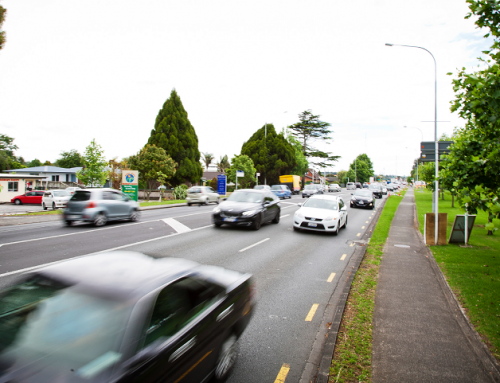
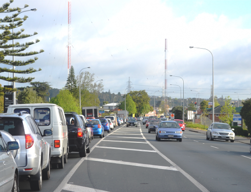
Traffic flow data was gathered using CCTV cameras and electronic tracking systems.
The CCTV footage was taken across a very wide area from Te Atatu Road to Swanson. The information gathered will be fed into a computer system that can map the traffic patterns. The other system was over a smaller footprint but it tracked the electronic signature of portable devices in vehicles from point to point along various roads, and importantly, Lincoln Road.
We hasten to add that the CCTV footage will be kept confidential and that the tracking devices cannot listen to phone conversations or read laptops. It can only detect an appliance in a vehicle and follow that along the road to give us a representative range of travel times along the road at different times and especially at peaks.
Among the modelling we will do from this data is to look at a range of many different scenarios for designing the road works themselves to give the best programme of works and the best traffic management plan that it is possible to achieve. Needless to say we cannot prevent disruption but we can plan to reduce it to the lowest possible level and for the shortest duration at any one time.
Among the options is, of course, night works and especially in the commercial/industrial areas where there are very few if any sleeping people to annoy.
We can give no guarantee on this matter at this time because the hours of work will be decided by a separate part of the AT organisation and will endeavour to take into account the greatest good of the greatest number. On Te Atatu Road, for example, which is almost exclusively a residential area, the hours of work were primarily business hours on weekdays. This was to give residents the opportunity for as much uninterrupted sleep as possible and a break from the working machinery at weekends. This did not make for the fastest delivery
However, the data we have collected for Lincoln Road will be modelled in a wide variety of ways, including how much evening work can be scheduled (if any) and what benefits that will bring to the project.
Nevertheless, we are conscious of many conflicting needs that have to be met that will also be “fed into the mix”. Examples include the needs of the hospital, the needs of the Arena, the huge demand around Te Pai netball courts (especially in winter), the needs of schools and the wananga, the needs of residents who have medical conditions, who have disabilities or who are vulnerable, restaurants, businesses with critical delivery times and undoubtedly many more.
As we have said before, we will be spending a great deal of time gathering this information in order to make our plans as fully informed as possible and to reduce the inevitable disruption as much as possible.
Another important opportunity is to use the data to model what is the optimum use of the Transit Lane (as requested by the CPHBA on behalf of the business community). The original plan for a T3 lane was based on the realities of a decade ago and so we now have the opportunity to explore which a range of options will give best service into the future. The options are Bus lane only, T3 with buses, T3 with buses and commercial vehicles, T2 with buses or T2 with buses and commercials.
This remodelling will also examine the best hours of operation. Needless to say, if the lanes will only operate for the peak hours – or some similarly limited period – the whole six lanes will become available to all vehicles outside of the peak and that will represent a 50 percent increase in capacity.
STAKEHOLDER LIAISON
While it is important for us to be able to communicate easily with the whole catchment – about 10,000 properties – we acknowledge that we must have a focus on the most directly affected stakeholders and that these are not confined to Lincoln Road itself. There is a surrounding area that is likely to be just as affected. We haven’t yet defined that area but it will almost certainly reach across to Rathgar Road on one side and Waipareira Ave on the other.
By the end of September we should also have the latest version of what is known as the 2-D design for the whole road. This will confirm the strength of the sub-surface and tell us whether the soil and present road structure will meet the demands of the new design standards for road building.
Coupled to this, and very important to the design process, is finding the exact location and depth of the current watermain (which will remain as is). If it is sufficiently deep that we can possibly lower the surface of the road, it will make for some major improvements to the design. The lower the road surface, the smaller will be the retaining walls that will be needed in many places; it will also improve the angle at which some driveways meet the road. If we are lucky it may even reduce the amount of land we need to buy from at least some of the properties.
The other benefit will be in helping us to design where we can plant new trees.

Artist’s impression of an intersection layout